Monday, December 29, 2008

What Baton Rouge is Doing for Walking and Biking

Matthew Linn has become a member of Baton Rouge Advocates for Safe Streets ("BRASS") in part to provide us with information on what they're doing. Below is what they sent in response to his membership contribution. It contains a lot of ideas for what we could do here.

Thank you for your recent, tax-deductible contribution to Baton Rouge Advocates for Safe Streets. We appreciate your support for making cycling and walking safer, more convenient, and more popular in Baton Rouge. We will use our resources of money, time, energy, and ideas as carefully and effectively as we can. In our first two years, we

  • provided bicycle and pedestrian information at public events,
  • staffed bike corrals at local festivals,
  • helped organize the first Mayor's Family Bike Day,
  • provided input through the Capital Region Planning Commission's Bicycle/Pedestrian Advisory Committee on local road projects,
  • delivered letters and petitions and met with the Director of the Department of Public Works regarding bicycle and pedestrian facilities in the Green Light Plan and elsewhere in the city,
  • participated in public meetings affecting bicycling and walking,
  • taken part in the dedication of the Mississippi River Levee Multi-use Path, and
  • established regular monthly meetings, regular bicycle maintenance classes, and a web presence (www.brsafestreets.org).

In our third year we have built on these efforts by

  • working with BREC to provide regular, League of American Bicyclists-certified bicycle safety classes (we had our first classes in May of this year)
  • working with BREC on the new Capital Area Pathways Project
  • participating in regular meetings of the Capital Region Planning Commission's Bike-Ped Advisory Committee
  • planning upcoming bicycle safety classes for kids with 4-H and East Ascension Mental Health Association
  • conducting monthly bicycle maintenance and repair classes
  • petitioning and meeting with DPW on their (recently dropped) opposition to installing bike-route signs
  • planning the routes and signs for the first bike routes to be signed inside the city limits
  • working on position papers to present to City-Parish planners on improving bicycle facilities in Baton Rouge
  • celebrating Bike to Work Day
  • organizing six successful themed rides on the trees, history, cemeteries, and public art of Baton Rouge (three last spring and three this fall)
  • planning regular SERF (slow, easy, recreational, fun) rides (we just had our first in December 2008)
  • participating in another Mayor's Family Bike Day
  • working with the Court Appointed Special Advocates (CASA) to acquire, repair, and make available a bicycle for one of their clients
  • petitioning the Mayor and the Metro Council for measures to improve bicycle safety in the wake of yet another recent cyclist death on River Road
  • organizing a memorial ride for cyclists killed on local roads
  • meeting with LSU planners about bicycle facilities and safety on and around the LSU campus
  • helping to organize a public forum of mayoral candidates to address planning and transportation issues
  • surveying city-parish council members on transportation issues
  • working with city-parish Department of Public Works and national Thunderhead Alliance to include two bicycle-pedestrian projects for 1.45 million dollars in possible federal economic stimulus legislation
  • sending representatives to the Louisiana Department of Transportation Bike-Ped Facilities Design Seminar
  • meeting with Plan Baton Rouge's visiting consultant on bicycle facilities for the Downtown Development District

If you haven't already done so, we encourage you to

Also, if you have a moment, we'd like to hear what you think about the following questions:

  • What pedestrian and bicycling issues concern you? Bicycling education and safety? Better road facilities to ride on? More off-road bike paths? Advocacy? Bicycling routes to schools for children?
  • Do you think Baton Rouge is a pedestrian and bicycle-friendly community? Do you see it changing for the better?
  • Would you be willing to contact your City Council member or state legislators about bicycling policies and legislation?
  • Are there other particular ways you'd like to participate, for example by writing grant proposals, mentoring people interested in bike commuting, donating bike-repair expertise, or doing something else?

We appreciate your support. We look forward to working with you in the coming months and years to make cycling and walking safer, more convenient, and more popular in Baton Rouge.

Sincerely,

Rick Moreland, Secretary-Treasurer

P. O. Box 19403

Baton Rouge, LA 70893-0403

Sunday, December 7, 2008

ABetterShreveport and The Civic Engagement Center get married!

There was no thrown rice or blushing bride, but it sure seems like we married a well-matched couple at our meeting last Thursday morning.

Stuart Greathouse acted as the "strategy facilitator" as we discussed the mission of ABetterShreveport (ABS) and how it was distinct from ABS' Greenways Committee, the Friends of Greenways Fund (tentatively titled), and the Center for Civic Engagement (CCE). After much talk about the purpose of each, the group arrived at a consensus that ABS should become a part of CCE. The following summarizes what the group discerned each organization to be:

Center for Civic Engagement: a 501 C3 non-profit organization intended to serve as an administrative and organizational resource center for collective efforts aimed at furthering pubic interests. The center does this by documenting processes involved in such efforts, archiving resources and accounts, and performing research in the public interest.

The center was started by Steve Shelburne, and is funded by a variety of grants and private donations. The primary private donor is Centenary College, which contributes monies, student internships, and a facility to house the center, as well as the Shreveport-Bossier Community Foundation.

ABetterShreveport: to serve as a forum for working on ideas for improving Shreveport and the region at large.

ABetterShreveport was started primarily by Loren Demerath and Ian Webb, but with much assistance from many others who've attended meetings over the past year and a half. It is unfunded, but meets, has an online presence, and has applied for grants using resources provided by the Centenary College Sociology Department.

The Shreveport Greenways Committee has been proposed through discussions to this point as follows: to serve as the driving force for making progress on the creation of a system of greenways that can be used for both recreation and alternative transportation in Shreveport and the surrounding area.

The Shreveport Greenways Committee would be made up of a specific, manageably small group of people who would be motivated, informed, and in a position to move the project forward.

While the group agreed to table the question of whether or not to create a separate non-profit organization for the Greenways project, one option that was discussed in past is to establish a separate "Friends of Shreveport Greenways" account within the Civic Engagement Center.

Much of last Thursday's meeting centered on how the mission of ABetterShreveport is similar to that of the Civic Engagement Center. Distinctions, though, include the way in which CCE is concerned with marshaling existing organizational resources, and ABS with providing an interaction forum that can act as an organizational incubator for forming to advance some public interest issue. In the end, the consensus seemed to be that the two organizations complemented each other and that it would be in the interests of both to work in conjunction with one another and see themselves as linked.

(So be it!)

We reserved some time at the end of the meeting to discuss how Ian and Loren should approach the meeting with Stacye Payne and Bill Lane of the National Park Service' Rivers, Trails, and Conservation Assistance Program. There was discussion over whether a greenways network should serve transportation needs over recreation needs, or vice versa, and it was agreed that neither should be the case. Optimally, the network would serve both needs; it was said that if the network either provided for transportation but not recreation, or for recreation but not transportation, it wouldn't achieve the unique set of outcomes in health, quality of life, and sustainable development that another kind of network could achieve.

As part of the new conjoining of ABetterShreveport and the Center for Civic Engagement, CCE will typically send a person to those meetings, and ABS meetings generally, to document and report on them. Typically, the recorder will be in the form of one of CCE's student-staffers that have been trained in that capacity, though at tomorrow's meeting it will be Steve himself.

ABetterShreveport's next meeting will be some morning next week, likely Wednesday at 8:20 (to allow Tuesday and Thursday a.m. occupied people to join us, if they like). I'll announce it here and via the e-mail list soon.

(By the way, if you're not on that list, and would like to be added, just email me at ldemerath@abettershreveport.org)

Tuesday, December 2, 2008

Meeting Thursday morning at 8:20...

Our next meeting will be Thursday morning from 8:20 to 9:30. We'll talk about a mission statement for ABetterShreveport, what the vision is, and the corresponding missions for the Greenways committee and for maybe for the Greenways account that would be set-up within the Civic Engagement Center as well.

Stuart Greathouse will be giving us a list of questions to think about. I'll post them too, assuming that's o.k. with SG.

We'll also discuss more directly this time what we should ask of the National Park Service team coming in next week.

Feel free to drop by even just for part of the meeting.

We meet in Centenary Square, across the street from George's Grill. Enter from the parking lot in back and you can't miss us.

Sunday, November 23, 2008

Could Louisiana do the same thing Montana is doing?

Effort launched to develop countywide trails plan

Published: Wednesday, November 12, 2008 8:25 AM CST
The Daily Inter Lake

The Flathead County Parks and Recreation Board is developing a countywide system of nonmotorized pathways to connect all the major population centers to each other, as well as Flathead Lake, Glacier National Park, Flathead National Forest and state and county parks.

The pathway system will include on-street pedestrian and bicycle routes as well as separate off-street pathways, according to a news release from the board.

An advisory committee -- People for Athletics, Travel, Health and Safety -- has been formed and charged with the task of developing a long-range master plan for county trails.

The committee has developed preliminary goals and met with representatives from state and federal agencies, county departments, municipalities and other interested groups. Base maps have been created, and some trails have been proposed to stimulate discussion.

PATHS is planning four community workshops in November to solicit ideas and comments from the public, which will be used to guide the committee's work. Johanna Bangeman is the chairwoman of the committee.

"We need to hear from people throughout the county about their desires regarding safe routes for pedestrians and bicyclists," Bangeman said. "I'm hoping the meetings in November will be well attended."

Rapid population growth is changing the rural lifestyle residents have enjoyed for more than a hundred years. Roads where people could once ride a bicycle or jog have now become unsafe due to heavier traffic. Traditional access is being lost to public lands and recreation opportunities in the area.

"Now is the time for trails planning," said Jim Watson, a member of the county parks board.

Pedestrian/bicycle pathways offer an alternative, connecting homes with schools, parks, offices, and shopping areas, Watson said. Upgrading roads with bike lanes and wide shoulders makes them much safer for bikers and walkers, he added.


The National Park Service Rivers and Trails Program is assisting the county in the planning effort.

"Pathways promote health and fitness by providing an enjoyable and safe place for people to exercise regularly," said Gary Weiner of the Park Service. "Off-street pathways can also provide close-to-home places for people to recreate in a semi-natural setting, and can function as meeting places for the community."

The workshops will be held at the following locations and times:

• Flathead Valley Montessori Academy (Somers): Nov. 17, 6:30 to 8:30 p.m.
• Columbia Falls Junior High School: Nov. 18, 6:30 to 8:30 p.m.
• Creston School: Nov. 19, 6:30 to 8:30 p.m.

• Kila School: Nov. 20, 7:30 to 9:30 p.m.


Good meeting Saturday, thanks to all!

Thanks to all who attended Saturday's meeting: Emily and Scott Sample, Maurice Loridans, Stuart Greathouse, Steve Godfrey, Michael Carmody, Matthew Lin, Jon Soul, and Ian Webb.

Ian talked about the NLCOG meeting he and Maurice attended this past week, and I reported on my, Shelly Ragle, and Tim Wachtel's meeting with Mike Strong. Both of those meetings, along with Steve Shelburne's report of his breakfast group discussions on the topic, caused us to see how a sub-committee of ABetterShreveport devoted to pushing greenways would be preferrable to handing that role to a governmental group or appointed commission.,

We also talked about using the expertise of walkers and bikers to take an inventory of the city's walking and biking options. One practice related to that, but that could also directly help people to get out and be mobile would be to share recommend walking/biking routes, such as through the map of recommended routes I had set up as an example.

We also talked about the importance of linking our alternative transportation network (be it made of trails, ped-bike boulevards, repainted streets, etc.) from places where likely users live to where they'd want to go. We agreed that while everyone in the city should eventually be considered users, many would't be until the city culture changes to see walking and biking as more viable, and a way of doing that is by catering first to those who are already ready and willing to use the network.

Seeing downtown as a destination was discussed as important, for what a revitalized downtown can mean for the city. We also discussed the possible limitations and possibilities for downtown to develop in the future.

Stuart Greathouse, who happens to own his own consulting business on organization efficiency, offered to help me get our group in order, and we'll be meeting with him on Thursday, December 4th, at 8:20 a.m. at Centenary Square. We'll be talking visions and mission statements.

One of the most important things to come out of the meeting was Matthew Linn's point that we should write a letter to the new planning firm that has just been hired by the city and ask that our group's work on greenways--specifically the plan that will be created with the help of the National Park Service starting early next month--be taken into consideration as they make their comprehensive master plan for the city. Matthew said he could send a letter from his position as a Caddo Parrish Commissioner asking that they consider our request. Of course, we could solicit similar letters of support from other officials as well.

Speaking of plans, there was talk yet again about an existing plan of a network of Greenways that we should attempt to get ahold of; it would help us advance the cause of greenways, perhaps regardless of how it differs from the plan we end up creating now.

Thanks again all! Our next meeting will likely be in December to plot for the National Park Service visit. Here's the question: what do YOU think we should do with our drainage-ditch system of bayous?

Thursday, November 20, 2008

Next meeting Saturday at 1:00, Centenary Square

The next ABetterShreveport is set for Saturday at 1:00. We'll meet at Centenary Square, across the street from George's Grill. Enter from the parking lot in back and you can't miss us, we'll be down in room 206 as usual.

If you can make it, and you're interested in advancing alternative transportation in Shreveport by implementing a network of multiuse paths, repainted streets, homemade trails, recommended routes, etc. please consider joining us on Saturday. The coffee will be fresh-brewed and waiting!

Tuesday, November 11, 2008

Public meeting for input on Statewide Recreation Plan

I can't help but think this might be another opportunity to push thinking forward on how recreation and transportation can be integrated. We don't have a statewide system of trails that can be used for bike travel, but perhaps we should.

This is from Tim Wachtel, SPAR Planner, and regular ABetterShreveport contributor:

There will be a public forum for input into the Louisiana Statewide Comprehensive Outdoor Recreation Plan update:
Tuesday November 18, 2008
6:00 - 8:00 pm
Southern Hills Park Community Center (near the pool)
1002 Bert Kouns Loop, Shreveport
The SCORP is intended to help guide the development of the State's outdoor recreation resources for the next five years. It is a requirement for the state and cities to get certain federal recreation funds, most notably grants from the Land & Water Conservation Fund (L&WCF).
I wish that I could send you a link to the current plan, but I can't find one. Here's a link to the State Park web site that has a way that you can fill out a user survey if you can't make the meeting:
Please feel free to let anyone who might be interested know about the meeting and the survey site.

Meeting tonight, City Council meeting last night, Greenways.com on the web...

Just a reminder that we meet tonight at 6 at Centenary Square, room 206.

By the way, I went to the City Council's work session last night on budgets, and had a chance to tell them about what we're working on. Those already in the know--Mayor Glover and Councilpersons Long, Lester, and Walford--were welcoming and glad to hear the update, and the rest of council seemed quite supportive.

Also, if you want to see the various forms greenways can take, check out www.greenways.com. We'll want to think about the possibilities when we discuss how the Park Service can help us.

See ya'll tonight, whoever can make it.

Thursday, November 6, 2008

Next Meeting is Tuesday the 11th, Centenary Square, 6 p.m.

We'll hold our next meeting on Tuesday (the 11th), at 6:00 p.m. at Centenary Square. We'll talk about the expertise coming in December from the Rivers, Trails, and Conservation Assistance Program provided by the National Park Service, and how we want to use it.

We'll also talk local initiatives we can move forward on right away, such as getting streets repainted for bike lanes. The video Maurice pointed us to in the post below sure is thought provoking in terms of things we could do. (Moving the parked cars out towards the center so the bike lane is totally protected from traffic was quite a sight. How luxurious!)

A couple of strategic, organizational moves we'll continue to discuss will be linking ourselves to Centenary's Civic Engagement Center, as well as asking NLCOG (Northwest Louisiana Council of Governments) to be our convener and government laison for our work on the bike-ped transportation network.

Enter Centenary Square across from George's Grill on Kings Highway from the back parking lot. You won't miss room 206, it's right down the hall.

Hope to see you there!

What works in New York could work in Shreveport... even better?

It's not the New York City you remember. Check out this interview and tour with New York's Department of Transportation Commissioner Janette Sadik-Khan:
http://www.streetfilms.org/archives/transforming-nyc-streets-with-jsk/

We'll probably all think: "Yeah, but Shreveport isn't New York." True. Some of what works there might not work here. But some things might work even better.

How about those protected bike lanes we see in the second half of the video? The parked cars are moved out away from the old curb to create a sheltered, inviting space for bicycles. Can you imagine that on Fairfield and Highland Avenues? On Marshal? Hmmm.

(Thanks Maurice!)

Tuesday, November 4, 2008

Being PAID to have fun and be healthy!

From our own Tim Wachtel:

"What will they think of next? This is from the ASLA web site:

On October 3, President Bush signed into law H.R. 1424, The Emergency Economic Stabilization Act of 2008, which is aimed at stabilizing the nation’s economy by providing assistance to our failing financial institutions....
Finally, H.R. 1424 establishes a program that encourages individuals to bicycle to work. Under the measure, commuters who bicycle to work could receive a monthly stipend for bicycle-related expenses. The stipend could be used for bicycle purchase, repair, maintenance, or storage, if the bicycle is regularly used for travel to and from work. While there have been several congressional attempts to encourage bicycle commuting, this is the first such program to be signed into law. ...

Here's the full article:
http://land.asla.org/2008/1104/bailout.html"

Monday, November 3, 2008

Today's meeting moved to Monday the 10th

No meeting today. We'll next Monday night, the 10th, at 6:00 at Centenary Square.
We'll talk about the National Park Service grant and what we want to do with the experts that will be coming in to help us. We'll also talk about targeting certain routes and neighborhoods for increasing the safety and appeal of walking and biking.

A Greenway-Canal Crossing Illinois

From an article in the Geneseo Republic on funding cuts to the Illinois State Park System:

"Geneseo, Ill. -

When construction on the Hennepin Canal finished a century ago, the waterway was considered built too small and too late to be useful in the railroad era.

Not wanting the canal, the Corps of Engineers turned it over to the State of Illinois, and, for many years, the 104-mile waterway struggled to find its identity.

Though it may once have been unloved, the formerly obsolete canal is a thriving state parkway beloved by nearly everyone ...everyone that is, except Illinois state governor Rod Blagojevich."

The article goes on to describe how the Governor planned to close all the state parks to save costs, even though they generate more money than it costs to operate them. The closures would include the canal, and the article then describes how a county Sheriff announced he would be asking for many thousands of volunteers to help him enforce the closure, effectively opening it to the public as "volunteers".

Ah, the creativity of politics and policy!

Thanks to Tim Wachtel, a Genesean himself, for the reference.

Tuesday, October 28, 2008

We got the grant! National Park Service Press Release below:

FOR IMMEDIATE RELEASE
October 20, 2009
Deirdre Hewitt, 404-562-3175

NATIONAL PARK SERVICE TO PROVIDE TECHNICAL ASSISTANCE TO LOCAL CONSERVATION & RECREATION PROJECTS

(ATLANTA)---The National Park Service has selected fifteen communities and partnerships in the Southeast to receive planning and technical assistance in developing new outdoor recreation opportunities and preserving important local natural resources.

Through the Rivers, Trails and Conservation Assistance (RTCA) Program, the National Park Service helps communities and neighborhoods preserve their important local resources, protect river resources, develop new trails and greenways and create new open space. These projects are locally-led with RTCA staff supporting local recreation and conservation leaders.

“We help citizens work with local agencies and organizations to create new parks and trails and to help protect important water resources,” said Deirdre Hewitt, who manages the RTCA Program in the National Park Service’s Southeast Region. “We do not provide money for projects. We provide staff with recreation and conservation planning expertise. These staff assists local sponsors to organize public workshops, develop public-private partnerships, identify funding sources and develop community-based visions and realistic strategies for new trails, greenways, protected river corridors and natural areas.”

Ms. Hewitt said that the National Park Service has been a catalyst in helping communities throughout the Southeast. “Each year we help community leaders accomplish their local visions across the region”. RTCA also helps bring new public and private partners to local projects. “The nation now recognizes the health benefits associated with close-to-home park and trail opportunities,” Hewitt said. “The RTCA Program is working throughout the nation to bring public and private members of the health profession into community partnerships that lead to new community parks and recreation facilities.”

Each year the RTCA Program evaluates requests for assistance and selects new communities and organizations for technical assistance. To serve communities throughout the southeast, the RTCA Program has offices in Asheville, North Carolina; Atlanta, Georgia; Chattanooga, Tennessee; New Orleans, Louisiana; and Sarasota, Florida, and Ocean Springs, Mississippi.

This is the list of projects accepted for assistance by the RTCA Program for Fiscal Year 2009.

Florida

River of Grass Greenway – The River of Grass Greenway (ROGG) is a proposed non-motorized transportation and recreation corridor across the Everglades, connecting this unique natural resource with the densely populated east and west coasts of southern Florida. The greenway will be approximately 75 miles long, with a separate hardsurface 12 foot wide trail that generally parallels U.S. 41 (Tamiami Trail), connecting Collier to Miami-Dade County. The ROGG will provide a pathway between the following parks: Everglades National Park, Big Cypress National Preserve, Ten Thousand Islands National Wildlife Refuge, Fakahatchee Strand Preserve State Park, Collier-Seminole State Park, Picayune Strand State Forest, and possibly the Rookery Bay National Estuarine Research Reserve.

Georgia

Pulaski County Blueway & River Parks Project – RTCA will help Pulaski County and the Town of Hawkinsville develop a plan for a 14 mile blueway on the Ocmulgee River that connects public launch areas in Houston and Pulaski Counties with the newly renovated river parks in Hawkinsville. There will also be linkages to the new Go Fish Visitor Center in Perry.

Boundary Waters Park Trail Project – RTCA will assist Douglas County with the expansion of their trail system in Boundary Waters Park. This system will be connected to the proposed 100-mile Chattahoochee Hill Country Trail that includes the counties of Carroll, Coweta, Douglas, and Fulton.

Upper Chattahoochee River Canoe Trail Study -- RTCA, the Upper Chattahoochee Riverkeeper and Georgia State Parks are working together to evaluate the feasibility of a canoe trail to connect 3 state parks, 2 federal parks, and a county park. The upper section of the river is between Helen and Lake Lanier.

Kentucky
Big Sandy River Water Trail – RTCA, the Big Sandy Area Development District and local communities collaborate on a water trail plan between Prestonsburg and Paintsville on the Levisa Fork of the Big Sandy River. The water trail will be promoted to generate interest in water quality, stimulate tourism, preserve local history and improve the image of the Big Sandy River.

Eagles Nest Equestrian Trails Preservation – The Commonwealth of Kentucky has an opportunity to protect 1000 acres of land and add over 30 miles of equestrian trails for public use near Harrodsburg. RTCA will assist the Ft. Harrod Back Country Horsemen, Inc., with a strategic plan to successfully secure this project site for future public equestrian use.

Jessamine County Historic Bluegrass Trail Project – The Jessamine County Trail Association intends to develop a countywide strategy to create trails and preserve the rural character. RTCA and local project partners will promote this project to designate bike routes, establish dedicated bike/pedestrian corridors and help maintain the existing rural landscape.

Louisville Loop Trail – RTCA will work with a local advisory committee to develop an organizational structure to sustain the 105 mile Louisville Loop Trail system currently being built around the city. The new management entity will enable the coordinated management, maintenance and funding for the Loop Trail among the many government and public groups with interests in the Trail.

Louisiana

Bayous to Use (Shreveport) – RTCA and the City of Shreveport will prepare a master plan for greenways and pedestrian/bike paths along existing drainage canals and levees. These drainage canals and levees offer the citizens of Shreveport a network of protected open spaces and trails. The planning process will include extensive public participation and the development of creative strategies to successfully implement the plan.

Dow Westside YMCA Trail (Addis) – The YMCA intends to build a 0.5 mile walking path on their site to promote healthy activity for their members and local residents. RTCA will assist with the planning process for the trail, publicity and public education to promote trail use by local residents.

Mississippi

Forrest County Multi-Use Trail Project – RTCA and Forrest County will prepare a county trail plan. The main connector for the trail system will be Black Creek from which a series of secondary trails will branch into communities. One of the proposed trails will connect an urban area between the Long Leaf Trace Rail Trail, the county hospital and University of Southern Mississippi.

North Carolina

Pioneering Healthier Communities – A variety of partners in Asheville are working together to implement a strategy that will make the City of Asheville more walkable, bikeable, and connected. The project will ultimately join neighborhoods, campuses, and downtown so that residents and visitors can increase physical activity and safely accomplish day to day activities depending on their feet and not their cars.

South Carolina

Lower Richland Passage of the Palmetto Trail Project (Midlands)– RTCA will work with the Palmetto Conservation Foundation and local governments to complete approximately 16 miles on one of the last sections of the Palmetto Trail system from Fort Jackson to the Wateree River. The entire Palmetto Trail will extend 425 miles across the State of South Carolina.

Upper Pee Dee Greenways, Trails and Blueways Initiative – RTCA will work with the Hartsville Family YMCA and the cities of Chesterfield, Darlington and Hartsville to prepare a plan for a network of greenways, trails and blueways in each community. The network of land and water trails and open space will connect each community to local and state parks, and promote economic development from new recreation and tourism-based businesses.

City streets closed to motor vehicles, once a week...

From a site found by Maurice Loridans:
"Recently, I had the opportunity to travel with comrades Karla Quintero (Transportation Alternatives) and Aaron Naparstek (Streetsblog) to Bogotá, Colombia to document some of the amazing advances going on in the livable streets movement there. On Sunday we spent the entire day - from 5 AM 'til nearly 5 PM - riding bicycles around the city courtesy of the Ciclovia, a weekly event in which over 70 miles of city streets are closed to traffic where residents come out to walk, bike, run, skate, recreate, picnic, and talk with family, neighbors & strangers...it is simply one of the most moving experiences I have had in my entire life."

See the film that this person made at:

http://www.streetfilms.org/archives/ciclovia/

Wednesday, October 22, 2008

Local, practical, "concrete" project proposed at last meeting

Had a good, if smaller, meeting this past Monday evening. Thanks to Centenary Business Professor Kelly Weeks, Attorney Maurice Loridans, Caddo Commissioner Matthew Linn, and Montessori Middle School Teacher Jon Soul for their contributions.

I'll edit this post later to include points we discussed, but the most exciting development was the idea that targeting local, practical means of increasing walk/bike-ability should be started. We're gonna be trail builders, by gosh! And even--potentially--crosswalk and bike lane requesters!

I also had a good meeting with SPAR Director Shelly Raigle and Planner Tim Wachtel. Shelly is setting up a meeting with the Director of the Department of Operational Services, Mike Strong, and we also agreed that approaching NLCOG to be the convenor would be a good move to make in the near future.

Saturday, October 18, 2008

Local demographics discouraging: Louisiana continues to lose solid citizens to other states

Demographer Elliott Stonecipher has tried to sound the alarm bell that contrary to what our leaders and others may be saying — Louisiana is losing residents to other states that offer more opportunity, writes Alison Bath in the Shreveport Times.

Population loss is a discouraging reality but perhaps a spur to groups like ABS. See the article here.

Friday, October 17, 2008

Good meeting Tuesday, next meeting Monday night!

First off remember we've got our first evening meeting of the year this year on Monday, at 6:00, in Centenary Square. Coffee and tea will be available, as will the internet and projection capabilities in case there's anything you'd want to show the group. (Usually we have google maps on the screen so we can zoom in and show various sites that relate to whatever we're talking about.)

Monday evening we'll be talking about:
  • The meeting I will have had that afternoon with Shelly Raigle, Director of SPAR, and Tim Wachtel, SPAR planner and ABetterShreveport contributor.
  • The value of ABetterShreveport becoming a 501 non-profit organization.
  • The opportunity of working with and possibly through The Center for Civic Engagement at Centenary.
  • Targetting Walk/Bike-to-School rates for specific schools.
  • Gaining access to the bayous slowly and legally, versus "quick and dirty."
We had a very good meeting this past Monday morning, and I wanted to thank, by way of introduction, all who attended and contributed: Steve Shelburne, Centenary English Professor and Founding Director of the Centenary Center for Civic Engagement; Jeff Wellburn, natural gas marketer and consultant (and a model of civic engagement himself); Paula Hickman, an attorney and Director of the Shreveport-Bossier Community Foundation; Tim Wachtel, Planner for the Shreveport Public Assembly and Recreation Department (SPAR); Charles Gerrard, Director of the Highland Area Partnership; Brad Armstrong, commercial real estate developer; Sally Spruel, Co-President of the Historic South Highlands Neighborhood Association; and myself, a sociologist at Centenary.

The short summary of our meeting is that we talked about the following:
  • how to think about funding the greenways proposal
  • what parties to involve in the working group that would push the proposal forward
  • the importance of making the greenways and trails part of an alternative transportation network that common origins and destinations
  • the utility of using existing infrastructure for that network that would include existing streets, some perhaps repainted with bike lanes
  • the utility of creating pilot transportation networks of trails and recommended walking and biking routes centered around schools, perhaps helped by:
  • our state department of transportation's Safe Routes to School Program
  • "mashups" where people are able to draw on online maps as a way of sharing their recommended routes
  • Steve Shelburne described his project of establishing an architectural restoration facility that could be situated in Highland or downtown.

The meeting began at roughly 8:30.

I started by reviewing our agenda, then updated the group on the status of our grant applications to the E.P.A. and the National Park Service for counsel on creating an alternative transportation network of multiuse paths and greenways using our existing infrastructure of levees, drainage bayous, and streets. Neither grant is for funding, though presumably some of the counsel we could get would be on how we should go about getting funding for the project. The gist of the update is that we haven't heard from the National Park Service yet, nor from the E.P.A. since our semi-final round interview.

I said that some of us on the phone for that interview got the impression that the E.P.A. was reticent about our application because we didn't have a governmental point person for the project. I said I had a meeting ahead with Shelly Wrangle of SPAR on Monday with Tim, and I asked about the team or work-group that we might want included. Jeff mentioned that DOS, and how Mike Strong or Wes Wyche would represent that at the upper level; Jeff also mentioned that Ali Mustafa is the water drainage engineer who is a great person to work with. It was said that other work group members might come from MPC, Shreveport Green, possibly someone from the Department of Health (obesity researchers in town were also mentioned), and the Department of Transportation Safe Routes to School Program (I mentioned Donna Cavenaugh of ThinkFirst). It was suggested that we consider asking the Mayor's office to lead it, or NLCOG. I mentioned that I'd talked to Dale Sibley about that originally. [Come to think of it, Dale may have suggested SPAR because he'd forgotten about the transportation network dimension of the project and was thinking of it more as just recreational. However, the transportation network aspect of the proposal should be part of it's appeal for funders, particularly when use of these networks has been shown to reduce wear and tear on roads.

I also described the idea that Jon Soul and I and Ian Webb had talked about on how we could target our own Montessori school's ride/walk rate with a number of strategies. One would be mapping the network of school families and constructing a set of recommended safe routes for "walking school buses" where a parent or two escorts kids on their walk or bike ride to school. (I do the walking thing myself; never thought I'd love it as much as I do.)

We talked about NLCOG as a possible convener for the working group if the Mayor's Office doesn't want to do it, or, even if it does, NLCOG might provide a better organizational vantage point if we want to apply the project to Bossier and places outside the city as well. For example, making a levee-top path that links Shreveport and Alexandria would be one application of the proposal that would fall outside the purview of city governments, but that would certainly be in the domain NLCOG. Paula Hickman described how NLCOG is often a conduit for federal monies used for transportation, and how they'd worked on getting the buses to run late [chuckles], and how they are the designated regional planning authority for our area. Paula said she thought NLCOG would be interested in working with our group. (I also mentioned how NLCOG's new bike-pedestrian advocacy committee met for the first time last week and five of our group on it [Maurice Loridans, Ian Webb, Emma McCarty, Robert Trudeau, and myself] and how it is trying to find potential members of the committee who are non-white.)

Steve Shelburne mentioned that as new public spaces, these greenways would be perceived as additional space that needs to be policed. Because of this, police officials should be brought into the planning process for the network sooner rather than later.

We also discussed why the working group would need GIS data, and how it will be helpful to know what software they use to work with it.

At 9:30 a number of people had to leave, but the meeting continued.

Steve talked about a project he's working on to establish a Restoration Facility somewhere in town. The facility would accept donations from demolition projects and renovations and would provide an outlet for cheap renovation materials. A number of them apparently exist in Dallas and bring in thousands of dollars in yearly revenue. Steve said facilities such as these help preserve historical materials and architecture details. Places like Shreveport's Highland area and downtown are in the process of losing such valuable materials without a facility like this.

I wondered aloud if it might also be able to serve an empowering role for people as well, in that the facility might be able to double as a center for mentoring apprentices learning construction, salvage, even tool maintenance. A bicycle shop or even car shop could also become part of the facilitation's communal resources. I described how a student of mine was working on a proposal for a tool collective in Highland.

The meeting ended at 10:00.

Monday, October 13, 2008

Next two meetings are set

Our next two meetings are scheduled: Tuesday the 14th at 8:30 a.m., and Monday the 20th at 6:00 p.m. Both meetings will take place at Centenary Square room 206. Bring your ideas, an open mind, and wisdom born of experience, and we can help each other move our projects forward.

On the docket for Tuesday morning's meeting:
- aspirations, ideas, and strategies for repainting streets for bike lanes
- forming a work group for the drainage bayous to greenways and bike paths proposals
- how to target areas and schools for increasing walk/bike to school rates
- downtown revitalization ideas

Fresh coffee will be on hand. Please join us if you can!

Tuesday, October 7, 2008

Bike Lane Video

Here's an interesting video on a different kind of bike lane. (Thanks Maurice!)

http://www.treehugger.com/files/2008/10/contraflow-bike-lanes.php

p.s. it's looking like we'll be meeting Monday evening at 5:30. let me know if you'd rather we start at six; i know one person would.

Friday, October 3, 2008

Let's meet!

Seems like a good time for it. After all, Kate Archer Kent was kind enough to publicize our group on KDAQ yesterday while I was on with her during their fund drive, but, when she asked when we meet, I was compelled to say we hadn't started back up yet this year.

Meeting could move us forward in existing directions and maybe get us started on new ones too. Anyone who's found out about the group and our ideas through whatever means might want to join us, and a number of us are working on various things we'd all like to hear about. I'll be happy to update people on the grants we've submitted, as well as the variety of project proposals my students are working on in my Urban Sociology class. Some of those projects have to do with Highland, some with biking, some with downtown.

So here's the question: what's the best time for us to meet? Monday evening at 5:30? Thursday morning at 8:30? Or Wednesday at noon, for a brown bag lunch?

Please comment here or e-mail me (ldemerath@gmail.com) to let me know what you'd prefer.

Wednesday, August 27, 2008

Property values and bike paths

Here's an article about how multi-use paths can affect home values, and even provide new ways of looking for a home. Realtors on bikes? Apparently so! (Thanks Maurice!)

Some home buyers' new must-have: a 'bikeable' commute

by Eric Mortenson, The Oregonian
Thursday August 21, 2008, 8:23 PM

Cyclists -- and prospective home buyers -- leave a Northeast 10th Avenue home en route to the next stop on a recent "Tour de Homes" organized by Portland real estate broker Kirsten Kaufman.

Every house on the market has its issues, and the Northeast Portland home that Emily Gardner was touring with broker Kirsten Kaufman is one of those the real estate fliers delicately refer to as "needs TLC."

It's small, smells bad, needs fresh paint everywhere and the electrical system is funky. Filthy carpeting covers the hardwood floors. The basement has a mysterious puddle, and it looks as though squatters kept a diary on a closet wall.

But the street is quiet and the house has a garage tucked under the main floor -- perfect for rolling bikes in and out to the street. From here, Gardner figures, she could whip down Ninth Avenue to Going Street, hop onto the Vancouver-Williams couplet with its comfortable bike lanes, cross the Broadway Bridge and in 15 minutes be at work downtown at the Bicycle Transportation Alliance.

"It's definitely a trade-off for me," Gardner says, noting that she could afford a "bigger, nicer house farther out."

Realtors notice change
Gardner is among a burgeoning class of prospective homebuyers. In addition to checking price, square footage and the number of bedrooms and bathrooms, some now are looking for houses that will allow them to ride a bike to work.

For them, "close to Springwater Trail" replaces "easy freeway access" as a market accolade. In a city that's among the national leaders in percentage of bicycle commuters, real estate brokers have noted the change.

Kaufman, of Prudential Northwest Properties, cultivates buyers who are looking to commute by bike or have the option of hopping on transit and want to walk to stores and services.

She's organized three bicycle tours of available properties, calling them "Tour de Homes." Meeting with about a half-dozen clients at a time, Kaufman has led visits of homes for sale in the Richmond, Sunnyside and Alberta east and northeast neighborhoods.

Besides showing homes, she highlights nearby bike routes, talks about bus, MAX and pedestrian connections, and rides past parks and schools.

"It's a way for people to explore neighborhoods in a way that's different than driving around," Kaufman said. "There's a lot of hype about green real estate right now. You hear about building materials, energy efficiency, solar -- that's all fantastic. But what more green thing can you do than drive less?"

Even Realtors on bikes
Realtor Kria Lacher of Meadows Group in Portland said an increasing number of her clients specify that they want to see "bikeable" properties.

"The other thing is, when I'm hosting my listings, some of the Realtors are coming by bike," she said. "That is new; that is very new. It changes the way you see a neighborhood, too. Your whole body is involved in the process."

Home prices have remained relatively strong in Portland's close-in neighborhoods, which generally have more transit options and better bike path connections than outer suburbs. Median sales prices in North, Northeast, inner Southeast and inner West Portland increased during the past year, according to the July market report issued by the Regional Multiple Listing Service. In most of the metro region, prices dropped.

"There are two significant trends influencing it" said Karl Rohde, public affairs director with Portland's Bicycle Transportation Alliance. "One is high gas prices; people are looking for locations that are less dependent on the automobile. The second one is a growing environmental awareness, the need to do what we can to reduce global warming. People do recognize that reducing automobile use significantly contributes to that effort."

Increasingly, they're doing that by bike. A 2007 city auditor's report showed that bicycle traffic at 31 monitored sites had increased 113 percent since 2000-01. Cyclists make 14,563 daily trips across the Broadway, Burnside, Steel and Hawthorne bridges, according to the auditor's office.

Roger Geller, the city's bicycle coordinator, estimates that 4.5 to 8 percent of Portlanders regularly commute to work by bike. In the central city, as many as 28 percent of commuters use a bike as their primary or secondary mode, Geller said.

Kaufman, the Prudential broker, hasn't yet sold a house she's shown on one of her Tour de Homes. But in June she sold a Clinton Street neighborhood home she had marketed based on its proximity to a bicycle corridor, and last spring sold a house to a couple who moved from Vancouver specifically because the husband wanted to bike to work.

She's sending bike-friendly listings to prospective clients in New York and California.

"There's definitely not a formula," Kaufman said. "When you're looking at a house, there are all sorts of trade-offs you take into consideration. For people who are committed to driving less and using public transportation, it can be a real important factor."

-- Eric Mortenson

Thursday, July 24, 2008

Over 20 participants offer ideas on bike and ped planning at DOTD hearing

Here's a copy of Alex Kent's story for the Times. The similar Shreveport Blog story is here.

Residents tell road officials to include pedestrians, cyclists

By Alexandyr Kent
akent@gannett.com

Cyclists and pedestrians shared their ideas about transportation safety Wednesday. During a public meeting at the Broadmoor branch of Shreve Memorial Library, they brainstormed and presented their ideas to state officials and consultants.

"We recognize that we have a need to move vehicles, but that cannot come at the cost of personal safety" of pedestrians and cyclists, said Nick Jackson, of the Toole Design Group.

The Maryland-based consulting firm has joined Burt-Kleinpeter, a New Orleans-based firm, to help the Louisiana Department of Transportation and Development establish a statewide transportation master plan that's more inclusive of nonmotorists.

"From the very beginning of the project, it is the presumption that it will include bicycles and pedestrians," Jackson added.

Policy priorities will be outlined in the Louisiana Statewide Pedestrian and Bicycle Master Plan, which will be released in 2009. The public meetings, which are being held in cities around the state, are part of the group's 18-month effort to gather information from residents, plus city planners and transportation officials.

"We think that some of these roads are too fast for pedestrians and cyclists," said Tamila Allen, of Shreveport, as she addressed the group. She termed biking to work "a short and dangerous journey."

She later added the 20-plus residents who attended the meeting should organize.

"This group needs to get back together and form a fairly cohesive group to present (ideas) to the city," she said.

Jeff Wellborn, who works with the local chapter of the Sierra Club, urged the state officials and consultants to listen closely to local concerns.

"We're the ones who need to steer the ship and not them," he said.

Emma McCarty, a physician living in the Highland neighborhood, attended the meeting because she wants to bike to work. She's tried it but found auto traffic prohibitive.

Her group suggested city officials take a firsthand look at the problem.

"Make them all bike to work once a month so they at least understood the issues," McCarty said.

Residents also expressed a general frustration that traffic plans, like those implemented at the Youree Drive shopping corridor, made areas inaccessible to cyclists and pedestrians.

Brian Parsons, bicycle and pedestrian coordinator for La. DOTD, spoke briefly about the idea of taking a "Complete Streets" approach to road planning. If implemented, it would mean that new road or improvement projects would balance the needs of motorists, pedestrians and cyclists alike.

"We have lip service to it, but we're not doing it," Parsons said. He and the consultants hope the Statewide Pedestrian and Bicycle Master Plan — strengthened by citizen input — ultimately will help make roadways safer for everyone who uses them.

Wednesday, July 16, 2008

DOTD planning meet open to public input: Wed, July 23, 5 pm, Broadmoor Library

Loren Demerath writes, "I´ll be in the air flying home as this meeting happens, but I sure wish I could go. Hopefully Maurice´ll be there, and maybe you, April, Ian, Sally and others too."


In response to increased interest and demand for walkable and bikeable transportation options, the Louisiana Department of Transportation and Development has begun a planning effort to update their Pedestrian and Bicycle Master Plan.

The purpose of this effort is to review and recommend POLICY changes to address the needs of all the users of the transportation system, and by doing so, to reduce pedestrian and bicycle crashes across Louisiana. While this plan is not intended to result in a map of a statewide network, or a list of projects, the goal is to lay the groundwork to facilitate a statewide system which accommodates everyone who uses it.

You are invited to participate by attending one of our upcoming Public Meetings:

Shreveport
Wed, July 23rd, 5 - 6:30PM
Broadmoor Library
1212 Captain Shreve Drive

Thursday, July 3, 2008

All Pedal, No Gas blog

SHREVEPORT TIMES REPORTER ALEXANDYR KENT TRIES BIKE COMMUTING:

"I’ve gone live with the All Pedal, No Gas blog, which will be featured on shreveporttimes.com.

First, please bookmark the following blog URL and visit it daily. Please invite your friends to check it out!

http://www.shreveporttimes.com/apps/pbcs.dll/section?Category=ALLPEDAL

Wednesday, June 25, 2008

Bicycle advocate Maurice Loridans views the Clyde Fant Recreation Plan from a rider's point of view

From bike commuter Maurice Loridans to city planner Tim Wachtel:

Overall I am very pleased and impressed with the Clyde Fant Recreation Plan. You have done a lot of work and made valuable use of the input so far. I approve of almost everything with a few minor exceptions.

First, though, I want to amplify your plan on two points that were not emphasized. The Preston Ave trail connection is very important because it serves the large neighborhoods of Shreve Island, Broadmoor and Broadmoor Terrace. Don't just think how they would access by car and park but how they can enjoy the Parkway by bike from their doorstep.

Currently you have to carry the bike over grass because of goathead thorns to/from the parkway and ride along a shoulder of the Parkway that jars your teeth because of deep cracks and is full of debris. Then you either ride on a bumpy slab sidewalk (technically illegal) or share a high traffic two lane that people do 45 and 50 on which is not appealing to the casual recreationalist. Please extend the trail to Captain Shreve. Just take that sidewalk and overlay with asphalt.

Next, there is the underpass that leads from the bike trail at the wooden bridge, under the Parkway to the Coats Bluff area. Please fix the drainage there too, like the underpasses at the Disc Golf Course.

Did I understand that an extension of the trail to C. Bickham Dixon would not be open to cyclists? Even on blacktop? Not good. This Greenway has potential as and alternative transportation corridor but it needs to serve neighborhoods at LSUS and Shreve City Shopping. It is not that much to ask that it be functional as well as recreational.

Think of students and shoppers, Farmer's market customers and Festival goers not having to use their cars and having such a pleasant greenway to use.

The only proposal I really disagree with is doing away with the informal parking across from SciPort.

First, there is not enough parking in the area. The Railroad is famously uncooperative about giving up their property, it is the best parking for the interactive fountains, and as a canoeist, I can carry my boat, paddles and life jacket to the dock and launch in one haul. I couldn't do it from where you propose.

best regards,
Maurice Loridans
attorney at law

Monday, June 23, 2008

See the city's Plan for outdoor recreation along the Clyde Fant Parkway


CrossBayouShreveport
Originally uploaded by trudeau
Shreveport Public Assembly & Recreation is preparing a plan for outdoor recreation along the Clyde Fant Parkway, says Tim Wachtel. After considering public comments from our Recreation Master Plan and working with a panel of local experts in recreation, conservation, special events, zoning, and history, we prepared a 2nd Draft for public comment. You can see it here.

This draft is intended to be a starting point for a community discussion of the future development of outdoor recreation along the Clyde Fant Parkway. We care what you and your neighbors think, so let us know! You are free to comment any way you please: phone, fax, mail or email.

Please send your comments to:
Tim Wachtel, ASLA, Planner III, 505 Travis Street, Suite 560, Shreveport, LA 71101
Phone: (318) 673-7721/Fax (318) 673-7878
Email: timothy.wachtel@ci.shreveport.la.us (Please put “Parkway Plan” in the Subject line.)

We are also having an "Open House" for the Plan on Thursday June 26 from 5 to 8 pm at the pavilion at the Stoner S'port Marina. This is not a "meeting," so you can stop by at your convenience to see the plan, discuss your ideas, and "vote" on what you like and don't like.

Monday, June 9, 2008

Times intern AJ King writes on bike and bus commuting

Quoting Sportran's Gene Eddy and River City Bicycling's Ian Webb, Times intern AJ King has written a recommendation for alternative transportation in Shreveport.

And comments, if a bit discouraged in tone, have begun to accumulate.

Saturday, June 7, 2008

Roll-out of blue bins for Shreveport has begun; you'll get yours soon

The City of Shreveport, thanks Mayor Glover, et al, and Pratt Industries, have delivered a new day to the old town. It's called single-stream recycling and you'll read all about it at justcurbit.us.

Maybe the question is how SptGreen, A Better Spt and the Planning Commission and other groups might capitalize on the optimism of the affected citizenry by offering them next-step buy-ins.

Sunday, June 1, 2008

Shreveport Times' Discussion Forum for Master Plan

Jeff Wellborn just alerted me to the Shreveport Times’ forum for discussing the our city’s master plan process. Craig Durrett has set it up, and he’s started it off by posting Don Shea’s letter to the Metropolitan Planning Commission. Craig pointedly asks visitors to the site what they think about Don’s comments, and it’s a good chance to document concerns and hopes any of us might have. The site is: http://www.shreveporttimes.com/apps/pbcs.dll/section?category=PluckForum&plckForumPage=ForumDiscussion&plckDiscussionId=Cat%3a72a6de5e-bea5-4bb9-8a51-0a9d30f04b1eForum%3a73c6794a-c02c-44dd-bd63-e020a9370030Discussion%3a34970d92-592a-41be-a704-a6202c742d7e

Last Week's Meeting on Downtown Development

Sorry for being so tardy in publishing a summary of our last meeting. Since Sunday I've been in Ecuador leading a course module for Centenary with my wife Janine, and I'll be here with the family until the end of July. (Writing now from a lodge at 14,000 feet above sea level below the world’s highest active volcano! Ah, the wonders of wireless internet.)

So, I won't be summarizing meetings for a while, but I hope to be able to keep contributing to our group from down here.

The meeting we had almost two weeks ago now was helpful, particularly to those of us trying to understand how our downtown can be improved, and how the ideas we develop in our "ABetterShreveport" network could help.

First, I want to thank Chris Jay and the other folks at Robinson Film Center for letting us use a room for our meeting. After Mike McSwain had to cancel hosting the meeting at his offices, Robinson it turned out to be quite appropriate a place to meet. After all, one of the things we want to do is bring in other attractions to downtown that will compliment Robinson and bring pedestrian traffic to their area, and we want that to happen before it's too late, as it has been for many a failed Texas Street business venture before Robinson Film Center.

We organized the meeting to learn what we could from Gregory Kallenberg about what his experience doing development work working for Whole Foods means for getting something like that in Shreveport. One of the things we learned is that stores like WholeFoods are unlikely to come here because our upper income population isn’t big enough. Moreover, such places are even less likely to locate in our downtown, since they tend to establish stores in areas that already have a high number upper income shoppers, as well as a capacity for significant parking. That resonated with what Don Shea, head of our Downtown Development Authority, told me once: that retailers don’t lead, they follow. The shoppers have to be there first, in other words.

That said, a vision of downtown development that would be within our grasp was articulated at our meeting by Stanton Dossett. He described the strategy used by Fort Worth of bringing in local, smaller retailers through incentives and local government leadership. It’s an example of the kind of public-private partnership that can really work. But Stanton and Greg and also pointed out ways in which that partnership can become dysfunctional and taken off course if the participants aren’t “on board” with the vision of what is supposed to happen. From what I understood, a common problem is developers and retailers calculating profit rates and economies of scale that are unrealistic for a given point in a downtown development process.

Some of the other things that were discussed were… [o.k., gonna finish this later. ]

Friday, May 23, 2008

Everything Ever Wanted to Know About Greenways, But Were Afraid To Ask!

Sharron Swanson sent me this draft of an article on greenways. It's very thorough and should answer a lot of questions people might pedestrian-bike paths, linear parks, and the like.

Please note that the article is a draft, and is copyright protected; do not cite or use it without permission of the author.

-----------------------
Happy Trails: Greenways for Everyone
by Hannah Twaddell

Believe it or not, some people's lives are improving because of
America's skyrocketing gas prices. Bicycle and pedestrian planners are
suddenly finding themselves very popular as people scramble to find
ways to cut back on their driving.

According to a recent USA Today/Gallup Poll, 84 percent of Americans
are changing their travel habits in response to the gas crisis. Where
folks once thought nothing of hopping in the car for every trip, they
are now consolidating errands, carpooling, taking transit, bicycling
and walking whenever they can. Bike shop owners like Hervey Hawk at
Cycle Cave in Albuquerque are doing a brisk business in repairs for
people who are "dragging 30 and 40 year old bike out of the garage" so
they can ride them to work. What's more, many of us are coming to
believe that high gas prices are here to stay. These "alternative"
forms of transportation may well become the norm for us over the next
few years.

Adding to people's desire for bike and pedestrian routes --
particularly greenway trails -- is the growing nationwide concern over
the public health problems related to our sedentary lifestyles.
Greenways offer an attractive, safe way to get everyone outside for
exercise, from children struggling with obesity to seniors wishing to
stay active. Veteran greenways planner Charlie Denney of Alta Planning
+ Design says people at public workshops are no longer asking, "why
should we spend money on trails?" but "when can we get them under
construction?"

What Are Greenway Trails?

A greenway is any open space corridor that is managed for
conservation, recreation, and/or transportation. A greenway trail is a
linear corridor with protected status that provides public access for
recreation or transportation. [footnote: Trails for All Americans,
National Park Service and the American Trails coalition] Greenway
trails can be found within natural corridors, such as a riverfronts,
stream valleys, or ridgelines, or man-made routes such as railroad or
utility rights-of-way, canals, or scenic roads. [footnote: As you
embark upon a plan, be sure to clarify whether you are proposing a
greenway, a trail, or both. A greenway can be created for the purpose
of land preservation, not necessarily with a trail. A trail is a
public pathway that may or may not traverse a greenway that is
protected through purchase or easement. Some landowners are willing to
donate, sell, or grant easements for a greenway but not a trail.
Others are willing to support the trail but don't want restrictions on
the land.]

A cost-effective, low-impact way to connect people and places
together, greenway trails typically link parks, nature reserves,
cultural features, or historic sites with each other and with
communities. They can be paved or unpaved, and designed to serve a
variety of trail users, including hikers, walkers, joggers,
bicyclists, skaters, horseback riders, and people with disabilities.

Up until a few years go, greenways were largely considered a
recreational amenity by transportation professionals and local
residents. But a shift in thinking has started to happen. People begin
by using the trails for recreation, but then start finding ways to
access them from local streets. From there, it's not long before these
interconnected networks are used for everyday transportation.

Communities of all sizes are designing greenways that tie into streets
and sidewalks, forming one continuous bicycle/ pedestrian network. For
example, the Philadelphia East Coast Greenway plan aims to connect
major tourist destinations and city neighborhoods into Center City.
The Louisville Loop will connect more than 100 miles of trails and
sidewalks throughout the city, while rural Montgomery County, VA,
recently completed a plan to link five villages.

Creating Greenways: A Four-Step Path

Step 1) Organize: Cultivate a sustainable, citizen-led advocacy group
with strong leadership and a clear vision. Most of America's greenways
and trails have been created by community members. The keys to
long-term success are two-fold: leadership and support.

The most important element is a core leader or leaders who have a
clearly articulated vision and the ability to recruit others to help
realize it. The ideal candidate for project leader is someone who has
strong communication skills and can foster teamwork; understands how
government works; is sensitive to people's varying needs and desires;
and has tenacity and patience.

The second key element is to sustain the effort over the long haul by
forming an efficient, well-managed team. Citizen leaders should
include people from communities along the proposed corridor as well as
potential user groups, businesses and civic organizations. The group
should actively engage public and private planners, engineers, and
administrators of preserves and parks as well as transportation
facilities.

Step 2) Plan: Create a plan that enjoys broad public support

First, develop a simple conceptual plan and mission statement to share
in one-on-one or small group meetings with public officials, community
leaders and, especially, landowners along the proposed corridor.
Soliciting this early input is critical to success. This is not a time
for negotiating easements or talking about public funds, but a time to
let people know about the group's vision and, most importantly, to
listen to their ideas and concerns.

To write the full-fledged plan, engage professionals in landscape
architecture, community and recreation planning, public participation
techniques, civil engineering, and architecture. Public agency staff
may be able to do this in-house, but the most effective approach is
usually to hire consultants who specialize in greenway planning.
Organizations such as Rails to Trails and the American Planning
Association as well as public agencies such as state departments of
transportation and parks/ recreation, maintain consultant databases
and can provide ideas for developing Requests for Proposals. If public
funds are used to develop the plan, it's important to follow the
relevant agency procurement requirements.

The plan should include a physical inventory of the proposed corridor
area(s), ideally produced in a series of GIS map layers that can be
kept up to date. Key data includes:
-- topography
-- hydrology and flood plains
-- wildlife habitats
-- existing or residual environmental contamination
-- roadways and roadbeds, rail lines (active and abandoned), trails,
and other engineered facilities
-- public services and utilities
-- scenic resources
-- historic and cultural resources
-- demographic and socio-economic characteristics of the community and
potential trail users
-- parks, open spaces and community facilities
-- current and planned land uses
--property ownership

The plan should include an analysis of trail demand among community
residents and visitors, displayed on a map of estimated trips at
various points. [footnote: A standard reference for estimating trail
demand is the US DOT Compendium of Available Bicycle and Pedestrian
Trip Generation Data in the United States.] Another element is an
assessment of potential economic benefits such as increased property
values and business revenues; new jobs; increased corporate relocation
and retention, and collateral development such as B&B's and regional
tourism. [footnote: The National Park Service publication Economic
Impacts of Protecting Rivers, Trails, and Greenway Corridors is one of
many useful resources on estimating economic benefits of potential
trails].

Thirdly, the plan's feasibility must be considered. Consider the
likelihood of acquiring the land and funding for construction and
maintenance; gauge the level of public support; and determine which
entities could own and operate it.

All of this information is assembled into a draft master plan that is
ready to share with stakeholders and the larger community. Then a more
detailed trail development plan can be developed that shows elements
such as access points, road crossings and bridges, gates and culverts,
and amenities such as information kiosks and rest rooms. The plan also
provides an overall design theme that supports the intended trail
users, and is consistent with the character of the surrounding
community. Finally, it identifies an implementation strategy with cost
estimates and funding sources, as well as approach for ongoing trail
management and maintenance.

Step 3) Build: Acquire right-of-way and construct well-designed paths


The most challenging part of many greenway development projects is
right-of-way acquisition. It helps to understand real estate law and
negotiation tactics in order to acquire the necessary titles, leases,
easements, and/ or access agreements. In addition to the tedium of
legal process, this is the stage when misperceptions can stall
enthusiasm. Landowners and municipal governments often worry about the
liability of allowing public access to their land. Get familiar with
state codes and municipal insurance policies -- they usually provide
indemnification for greenways.

Another misperception is that trails will invite crime and/or reduce
property values. In fact, properties in the vicinity of trails tend
to sell faster and for a higher price than neighboring
lands.[footnote: Trails and Greenways: Advancing the Smart Growth
Agenda, Hugh Morris, Rails to Trails Conservancy, 2002, Page 19]. And
studies show that trails can actually help reduce crime by attracting
people to formerly abandoned areas." [footnote: Rail-Trails for Safe
Communities, by Tammy Tracy and Hugh Morris of the Rails to Trails
Conservancy for the National Park Service, 1998. page 1]. For
instance, the Baltimore-Annapolis rail/trail was built in an abandoned
area of Anne Arundel County that had been plagued by drug dealers.
Within six months of the trail opening, no arrests were being
reported, and businesses were starting to move into the area. "Once it
was re-created as a place people wanted to go," says Charlie Denney,
"the crime went away."

Greenway trails, like all public spaces, do benefit from simple design
techniques to reduce the likelihood of crime, such as lighting,
call-boxes, and well-pruned shrubbery. Many trails are policed by
volunteer or professional patrols. Arlington, VA and Louisville, KY
trail markers are color-coded with a GPS location in the city's
emergency-911 database, allowing trail users with cell phones to tell
police where they are.

When designing and building trails, it's important to adhere to basic
construction standards, from clearing foliage and establishing the
foundation to managing runoff and water crossings. Trails must also be
designed to support all desired users. Low-hanging branches are all
right for hikers, but not for cyclists and equestrians. [footnote:
Useful resources include The Rails-to-Trails Conservancy's Trails for
the Twenty-Fist Century and Greenways, A Guide to Planning, Design,
and Development, and How Greenways Work and the Trail Construction &
Maintenance Notebook by the National Park Service. ]

Funding sources for trail planning and construction include federal
monies such as US DOT Transportation Enhancement grants and the
National Park Service Rivers, Trails, and Conservation Assistance
program as well as state and local DOT and parks/recreation programs
and private funds from foundations and donors. Municipalities can
also negotiate with or require developers to incorporate trails into
their projects. [footnote: When working with a developer, make sure
the trail is properly engineered and that is built concurrent with the
rest of the project. Everyone loves trails when they're part of a new
development, but opposition is inevitable when you try to build them
after folks have moved in.] Smart developers are realizing that
greenways are a fairly low-cost investment that can considerably raise
the value of their project these are amenities people want.

Step 4) Operate: Administer and maintain the greenway system

It's very important to make sure trails are well maintained. Costs
vary widely depending on the size and complexity of the system, but
one should budget for tasks such as the following:

Routine Maintenance
-- Daily security patrol and cleaning of comfort stations
-- Weekly refuse removal and grass cutting
-- Monthly and post-storm maintenance inspections
-- Quarterly brush cutting
-- Seasonal and post-storm clearing of culverts and drains
-- Snow and debris removal and minor repairs

Long-Term Maintenance
-- Inspect bridges and tunnels yearly
-- Repaint blazes and repaint buildings every 5 years
-- Resurface trail every 10 years
-- Renovate buildings every 10-20 years

Greenway managers also have to supervise professional and/or volunteer
staff; raise operational funds and administer the budget; manage
conflicts between users, and implement trail policies, as well as
maintaining good relations with the community and continuing to plan
for future trail development. [footnote: Useful references on trail
operations and maintenance include the following: US Department of
Agriculture -- Forest Service, Technology and Development Program.
Publication 4E42A25 -Trail Notebook. (1996). Trail Construction and
Maintenance Notebook. Missoula, MT:USDA-FS Missoula Technology &
Development Center; and US Department of the Interior -- National
Park Service, Denver Service Center. NPS-2023. (1992). NPS Trails
Management Handbook. Washington, D.C.: U.S. Government Printing
Office.]

Municipalities should allocate annual funds for management and
maintenance as well as capital improvement funds for major work. If
the trail spans multiple municipalities, cost-sharing agreements can
be established. A DOT may work out an agreement with a municipality
for maintenance of trails in the state right of way. Privately
operated trails are usually maintained with donor dollars and
volunteers.

Summing Up

Local planners and officials are well advised to get ready for rapidly
increasing pressure from the public to improve and expand our networks
of sidewalks, bike routes, and multi-use trails. If your community
already has a greenways plan in place, start looking for ways to put
more money into construction. If you don't, it's high time to get your
planning efforts underway.

------------------------------
--------------
Hannah Twaddell is a Senior Transportation Planner in the
Charlottesville, Virginia, office of Renaissance Planning Group. Her
"Forward Motion" column appears regularly in the Planning
Commissioners Journal.
--------------------------------------------
** Please note that the above article is copyright protected. Please
contact us at: editor@plannersweb.com before copying or distributing
this article for anything other than your own personal use.
--------------------------------------------

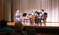
Video footage of our first free bike clinic...

Here's some video of our first free bike clinic held last Sunday. Kathryn Usher filmed this and has it as well as lots of other fun and interesting local reporting on her blog, redriverblogjam.blogspot.com.

Friday, May 16, 2008

Think bigger: a chat with Roy Jambor, MPC senior planner


SSO Luxury Car Raffle
Originally uploaded by trudeau
The Metropolitan Planning Commission is trying to bring a new planning Initiative to the public. In a downtown meeting Wed, May 21, 5:30 pm, the MPC will listen to comments at 505 Travis St, the Govt Plaza building (1st floor).

Jambor says his real target group for getting citizens involved in the planning process is elementary kids. He mentioned a program called Box City. He'd like to make an outreach beginning in 3rd grade (does MSS partcipate in any such?). Secondarily, he'd like to get college students engaged (rotsa ruck, Roy).

Anyway, the document is on the MPC website under a subtitle which says MPC Master Planning Meeting. You need the latest Adobe Reader version to see it, I think.

He says it's important for everyone to offer input, regardless of the meetings. Email or letters will welcomed.

This may be our last opportunity at creating a community-wide compromise toward planning, Jambor believes. One of the key questions: what do we do with our blighted inner city neighborhoods?

He points to Chattanooga and Denver as cities doing the smart urban adjustments.

And he says that there are signs of a growing acceptance of public transport in Shreveport. Evidently Sportran numbers are up. We need to build bus shelters to enhance the alternative, he says.